- Home Page /
- Office Products /
- Office & School Supplies /
- Education & Crafts /
- Geography Materials /
- Maps /
- Maps International World Wall Map - Map of Th...
0 ratings


Item #:
10243398
Maps International World Wall Map - Map of The World Poster - 23 x 33 - Front Lamination - Updated 2025
90% of respondents would recommend this to a friend
Item #:
10243398
€ 34
Price Details
Excluding Shipping & Custom charges ( Shipping and custom charges will be calculated on checkout )
*All items will import from US
In stock
QTY:
Order now and get it around Wednesday, June 24
Secured transaction
Ubuy works hard to protect your security and privacy. Our advanced payment security system ensures confidentiality by encrypting your information during transmission using AES (Advanced Encryption Standards) and SSL (Secure Socket Layer) protocols. Your payment details are 100% secure as we do not share your payment details with third party sellers.
Our Top Logistics Partners
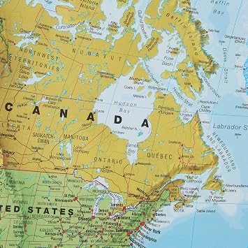
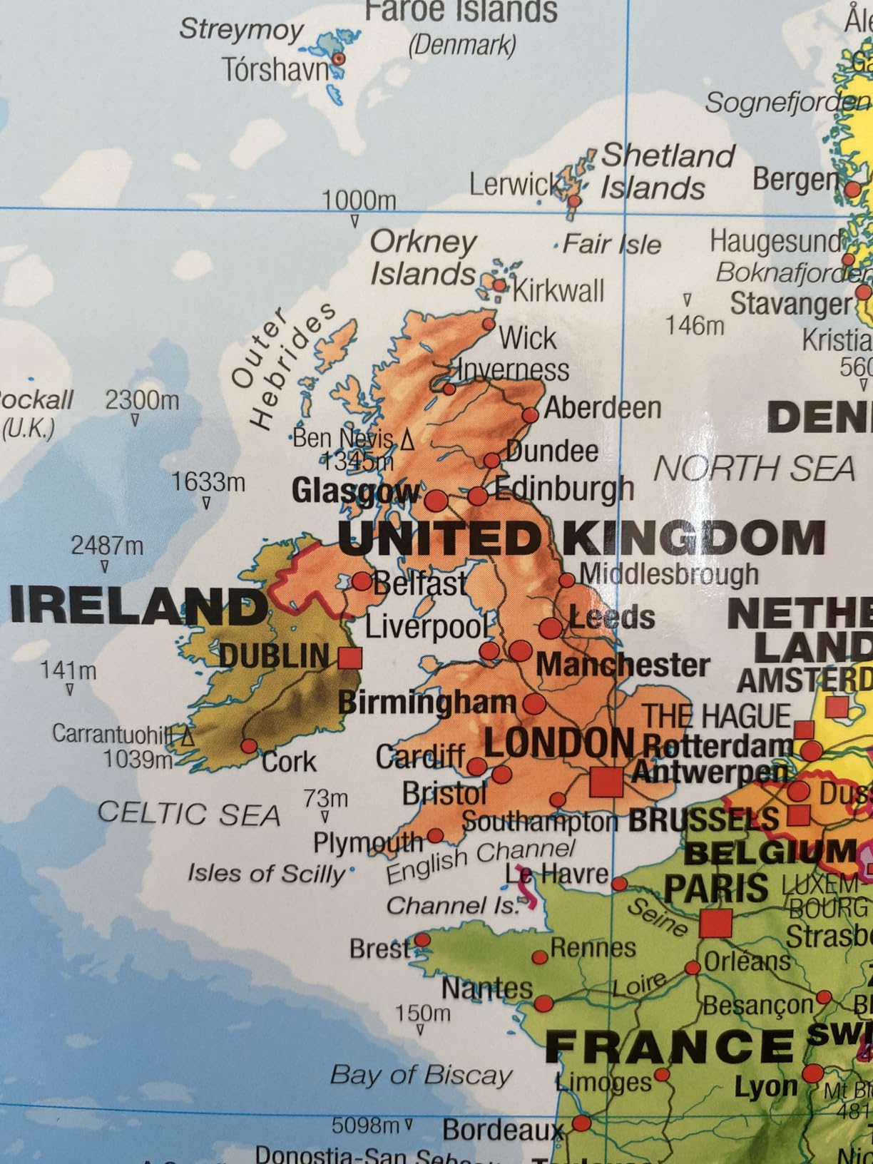
This big world map poster is a great way to brighten up classrooms, family rooms and offices.
Fast
Shipping
Free
Return*
Secure Packaging
100% Original Products
PCI DSS Compliance

ISO 27001 Certified
Note: Step Down Voltage Transformer required for using electronics products of US store (110-120). Recommended power converters Buy Now.


What Stands Out
Laminated Finish
The laminated surface offers durability and easy cleaning, making this map ideal for classrooms, offices, or homes without worrying about wear and tear.
Flag Inclusion
Includes national flags for a vibrant, educational experience, enhancing learning and sparking curiosity about different cultures and countries for both students and travelers.
Large Size
At 23 x 33 inches, this wall map provides a detailed view of the world, making it perfect for decoration and informative learning space in any room.
Product Details
- Political map of the world: created by expert cartographers, the large world map poster features every country in a different color along with hill shading and time zones.
- World map poster: a beautiful addition to any office or family room wall, world maps add color and interest and this world map poster will blend with any home décor.
- Write-on finish: this world map has write-on, wipe clean front sheet lamination and measures 23 (h) x 33 (w) inches - ideal as a home or classroom world map.
- Creaseless delivery: your colorful, wall map of world is rolled in a tube for delivery, so it arrives ready to display.
- Maps International: our philosophy of ‘cartographic excellence’ combines detail, design and high-quality finishes in a range of stunning wall maps.
| Brand Name | Maps International |
| Map Type | Political |
| Manufacturer | Maps International |
| Part Number | WM006-554 |
| Model Number | WM006-554 |
| Paper Size | 23 x 33 inches (58.4 cm) |
| Item Weight | 0.22 Kilograms |
| Item Dimensions L x W | 23"L x 33"W (58.4 cm) |
| Color | 23 x 33 Front Sheet Lamination |
| Paper Finish | Matte |
| Brand | Maps International |
| Sheet Size | 23 x 33 inches (58.4 cm) |
Who Should Buy?

-
Education Professionals
Teachers and educators can use this map as a visual aid for geography lessons in classrooms.
-
Travel Enthusiasts
Ideal for travelers wanting to track their adventures or plan future trips with a visual reminder.
-
Home Decorators
Adds an interesting touch to home or office decor, especially in spaces themed around exploration or travel.

-
Compact Spaces
Not suitable for very small rooms or apartments where wall space is limited for larger maps.
-
Detail-Oriented Users
Users seeking a highly detailed or specific map may find this general map insufficient for their needs.
-
Budget Shoppers
Those looking for a more economical option may find the price higher than desired for a wall poster.
Product Description
Have any Query? Chat with us
Customer Questions & Answers
-
Question:
What are the dimensions of the Maps International Giant World Map?
Answer: The Maps International Giant World Map measures 46 x 80 inches, making it a truly expansive representation of the world. This large size allows for detailed viewing of geographical features, countries, and continents. It can serve as an educational tool in classrooms or as a vibrant piece of decor in homes and offices, allowing anyone to explore the globe from the comfort of their space. -
Question:
What features does the fully laminated surface provide?
Answer: The fully laminated surface of the Maps International Giant World Map ensures durability and enhances its usability. This protective layer makes it resistant to tears and scuffs, allowing you to write on it with dry-erase markers for notes or travel plans. This makes it perfect for anyone looking to mark locations they’ve visited or dream of exploring, while also presenting a polished look suitable for any environment. -
Question:
Is this map updated to reflect current geographical changes?
Answer: Yes, the Maps International Giant World Map is updated for 2025, ensuring that all geographical information is accurate and reflective of recent changes in borders, political names, and geographical features. This makes it an invaluable resource for students, teachers, and anyone who values geographical accuracy for travel planning or educational purposes. -
Question:
Can this world map be used in a classroom setting?
Answer: Absolutely! The size and clarity of the Maps International Giant World Map make it ideal for classroom use. Teachers can utilize it to illustrate geography lessons, helping students visualize continents, countries, and oceans. It can also foster interactive learning, as educators can encourage students to engage with the map for various activities, such as identifying countries or discussing world events. -
Question:
What kind of material is the map made from?
Answer: The Maps International Giant World Map is printed on high-quality paper and comes fully laminated for added durability. The lamination enhances the colors, providing a vibrant display that captures attention and detailed information, thereby enriching any space it's placed in. This material choice ensures that the map not only looks great but also withstands daily interactions without significant wear. -
Question:
Are there markings for major cities and landmarks on the map?
Answer: Yes, this map includes markings for major cities, landmarks, and geographical features around the world. This makes it very user-friendly, offering not just a broad overview but also detailed insights into significant locations. Whether you are a traveler planning your next adventure or a student preparing for an assignment, the map provides valuable information at a glance. -
Question:
Is this map suitable for personal use or as a gift?
Answer: The Maps International Giant World Map is versatile, making it a great choice for personal use and a thoughtful gift. Individuals passionate about travel, education, or San Marino cultures will appreciate its aesthetic and functional qualities. It's an exceptional gift for students, educators, or anyone keen on geography, offering an artistic piece that sparks conversations and inspires adventures. -
Question:
How can I hang this wall map?
Answer: Hanging the Maps International Giant World Map is straightforward. You can use adhesive strips, thumbtacks, or a poster frame to display it. Due to its large dimensions, a sturdy mounting method is recommended to ensure it stays in place. Once hung, it serves as an attractive focal point in a room, complementing various decor styles and encouraging exploration. -
Question:
Can I write on this map?
Answer: Yes, the fully laminated surface of the Maps International Giant World Map allows for writing with dry-erase markers. This feature is particularly useful for jotting down notes, travel plans, or marking places of interest. It transforms the map into a dynamic tool for learning and planning, allowing users to easily update it as their travel experiences evolve. -
Question:
Where can I buy the Maps International Giant World Map?
Answer: You can purchase the Maps International Giant World Map at Ubuy in San Marino. Ubuy is known for offering a wide variety of maps and educational materials, ensuring that you can find the perfect option for your needs. Their platform provides an engaging shopping experience where you can conveniently browse and select the map that's right for you.
MapsInternational Maps WM006-554 Editorial Review


The Maps International Large World Map is a great addition to any home or classroom. Measuring 23 x 33 inches, this laminated wall map features all 195 countries and their flags. The map is easy to read and has bright colors, making it perfect for learning geography or keeping up with current events. One of the standout features of this map is its lamination. While some customers noted that the lamination was not thick enough to prevent creases or damage, others found it to be sufficient and durable. The map can be rolled up and taken on the go without worrying about ripping. The inclusion of flags adds an interactive element to the map, making it engaging for children and adults alike. The flags are clear and easy to see, and the countries are labeled clearly. One minor drawback mentioned by a few customers is the lack of Antarctica on the map. However, for most users, this was not a major issue as they had a globe or other reference for Antarctica. Overall, the Maps International Large World Map is a high-quality and visually appealing map that is perfect for educational purposes or as a decorative piece in your home.
Customer Reviews & Ratings
7246 customers ratings
-
5 Star
87%
-
4 Star
10%
-
3 Star
2%
-
2 Star
0%
-
1 Star
1%
Review this product
Share your thoughts with other customers
Pros
- Laminated for durability
- Clear and easy-to-read
- Includes flags for an interactive experience
- Bright colors
- Good size for a study area or classroom
Cons
- Some customers found the lamination to be insufficient
Product Price History
Important information
- Limitations : For products shipped internationally, please note that any manufacturer warranty may not be valid; manufacturer service options may not be available; product manuals, instructions, and safety warnings may not be in destination country languages; the products (and accompanying materials) may not be designed in accordance with destination country standards, specifications, and labeling requirements; and the products may not conform to destination country voltage and other electrical standards (requiring use of an adapter or converter if appropriate). The recipient is responsible for assuring that the product can be lawfully imported to the destination country. When ordering from Ubuy or its affiliates, the recipient is the importer of record and must comply with all laws and regulations of the destination country.
- Not all the products listed on Ubuy are for sale, as Ubuy is a global search engine. Products are subject to export/trade regulations.
€ 34
Order now and get it around Wednesday, June 24
This item is not restrict in my country.(Please click on above link if this item is not restrict in your country, So our team will review and allow.)
QTY:
Secured transaction
Ubuy works hard to protect your security and privacy. Our advanced payment security system ensures confidentiality by encrypting your information during transmission using AES (Advanced Encryption Standards) and SSL (Secure Socket Layer) protocols. Your payment details are 100% secure as we do not share your payment details with third party sellers.
Our Top Logistics Partners
Fastest cross-border delivery
Features & Benefits
- Features educational flags for learning.
- Large size: 23 x 33 inches.
- Brightens up any space like classrooms and offices.
- Fully laminated for durability.
- Delivered rolled in a tube to prevent creases.
- High-quality finishes with a focus on cartographic excellence.